San Juan Islands Satellite Placemat
SKU:
ADV01
$7.50
$7.50
per item
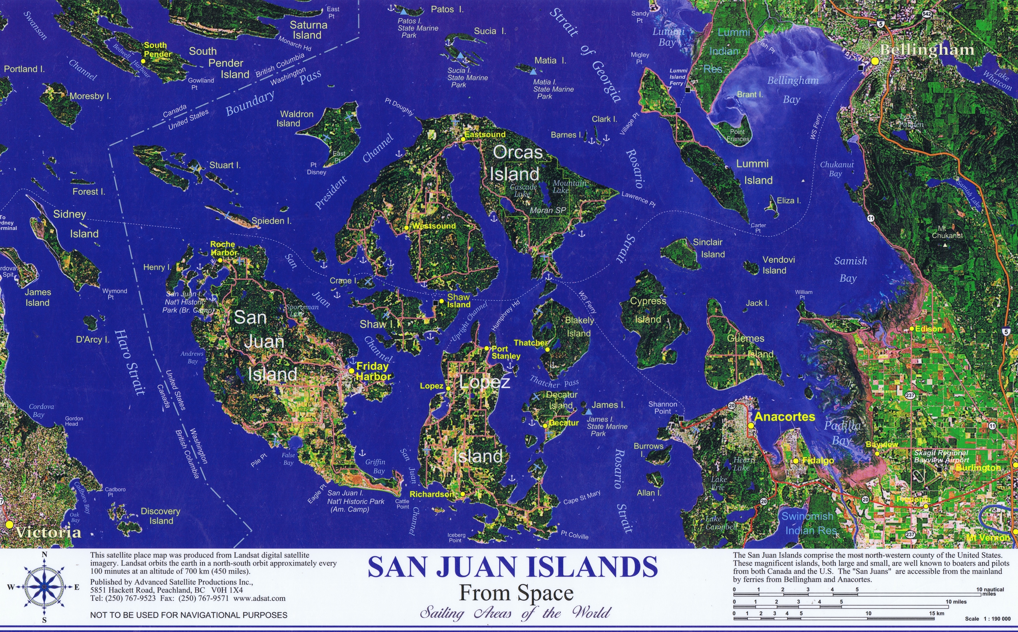
This San Juan Islands satellite placemat was produced from Landsat digital satellite imagery at an altitude of 700 km (450 miles).
The San Juan Islands comprise the most north-western county of the United States. These magnificent islands, both large and small, are well known to boaters and pilots from both Canada and the U.S. The “San Juans” are accessible from the mainland by ferries from Bellingham, WA and Anacortes, WA.
Placemat is laminated and measures 17″ x 11″
Sold out