Pacific Coast Planning Map South (Laminated)
Pacific Coast Planning Map South (Laminated)
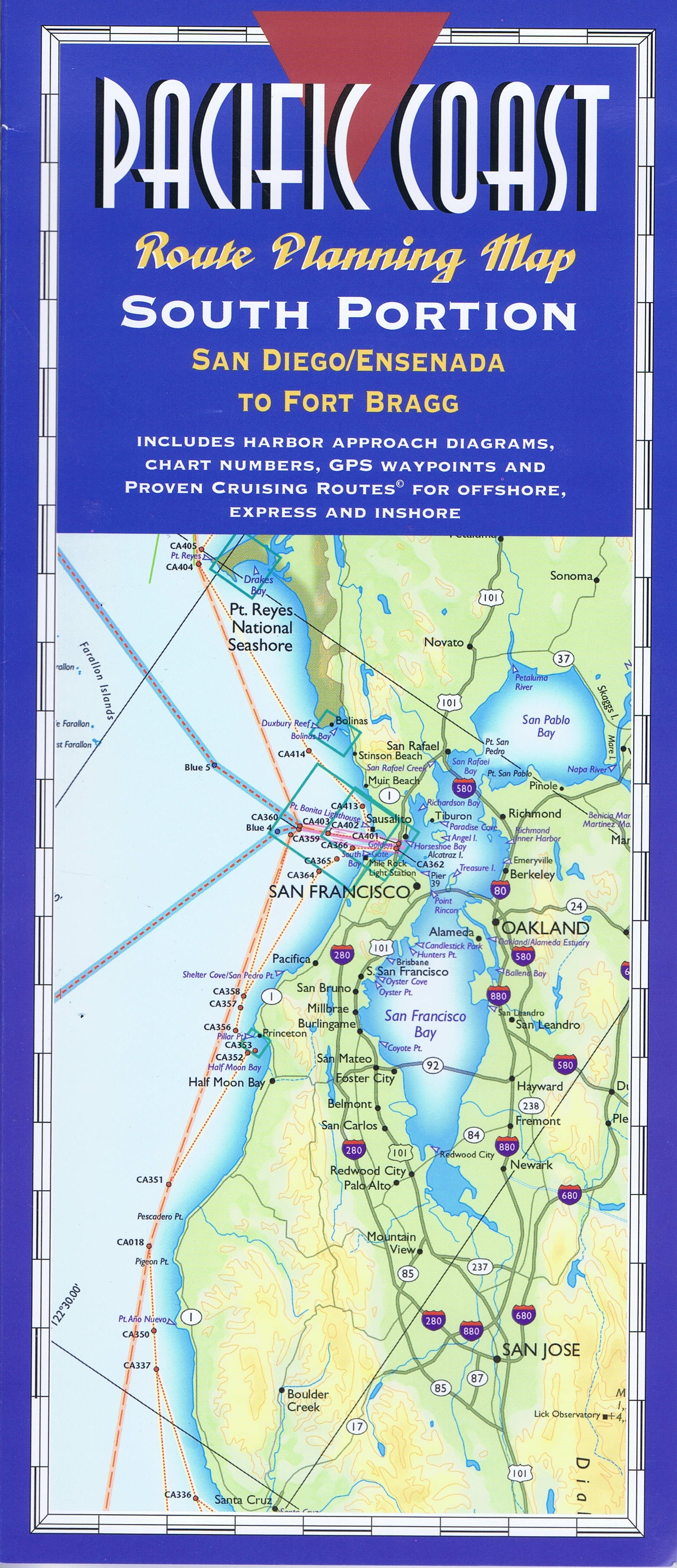
South Portion – San Diego/Ensenada to Fort Bragg
by Fine Edge Publishing
Our Pacific Coast Route Planning Maps are a new concept to allow a birds eye view of a large area of coastline in one view.
The map includes 500 places to tie up and anchor with three of our Proven Cruising Route (c) – Offshore, Express and our “one foot on the beach”, harbor hopping inshore route. All major place names are alphabetically indexed on the southern and northern portions of this FULL COLOR two-map series. Descriptions include geographical locations, nautical chart numbers, and nearly 6,000 GPS waypoints. This will help you locate all the named places, as well as hundreds of other coves on each map.
Unfolded, the map measures 24″ x 65″ and accordion folded measures 12″ x 5″. It comes in a color-printed storage jacket that features distance tables.